Project background
In October 2020 Council adopted our Foreshore Access Strategy to help improve and increase foreshore access in the City of Canada Bay. An opportunity identified in the adopted Strategy is to create the ‘Chiswick Shortcut’ past the Chiswick peninsula, connecting the formal foreshore walks between Abbotsford House, Lysaght Park and Drummoyne Oval.
The Chiswick Shortcut is being delivered as part of the Parramatta to Sydney Foreshore Link, proudly funded by the NSW Government.
What's happening?
Council will formalise this important link in our local walking and riding network by providing a continuous connection for people walking and riding along this route.
Improvements include:
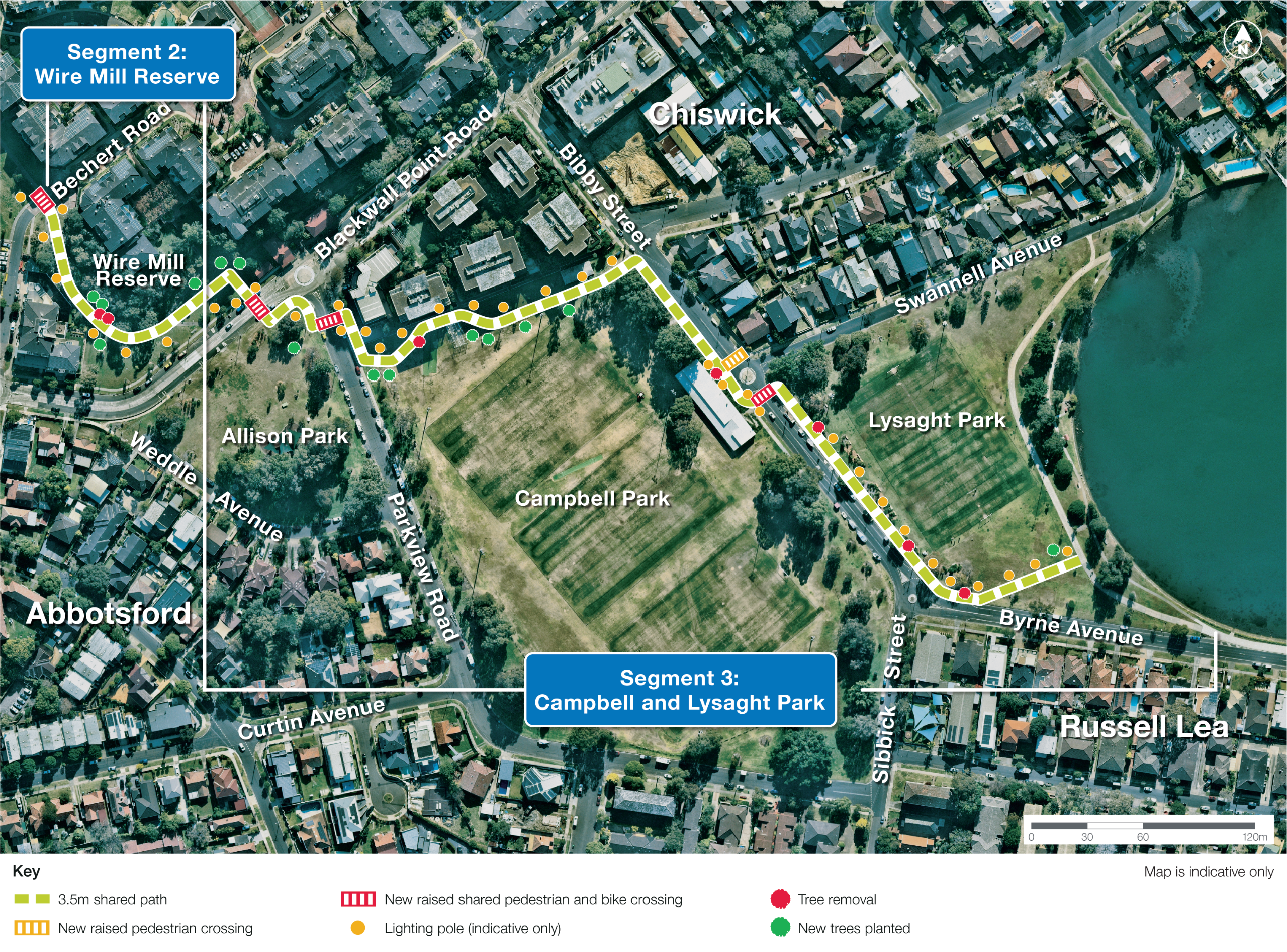
- Providing a continuous 3.5m shared path between Wire Mill Reserve and Lysaght Park by widening existing footpaths in Wire Mill Reserve and Campbell Park and building new shared paths along the border of Allison Park (between Blackwall Point Road and Parkview Road) and Lysaght Park to connect with the existing path along the foreshore.
- Building a new raised shared crossing on Bechert Road to replace the existing non-compliant crossing.
- Removing the existing pedestrian refuges on Blackwall Point Road (between Wire Mill Reserve and Allison Park) and Bibby Street (between Campbell Park and Lysaght Park) and providing raised shared crossings at new locations.
- Building a new raised shared crossing on Parkview Road to connect Allison Park and the residential area near Campbell Park.
- Building a new raised pedestrian crossing on Bibby Street, near Swannell Avenue.
- Installing signage and line marking along the new paths.
- Planting new trees and vegetation where feasible to provide additional shade cover and improve visual amenity.
- The bus zones located on Parkview Road have been decommissioned by Transport for NSW and will be removed.
- Parking will be adjusted as needed, with an overall loss of four parking spaces.
How will this affect me locally?
Some changes to parking will be required for the new crossing on Parkview Road.
Overall, four parking spaces will be removed near the new crossing.
Location map
Click image to view in full screen.